
File:1850 IC.jpg

Original file (3,536 × 5,856 pixels, file size: 2.99 MB, MIME type: image/jpeg)
Captions
Captions
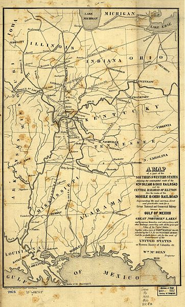
1850 map of the Illinois Central Railroad and New Orleans and Ohio Railroad (which became part of the IC) from [1]. Also shows the Mobile and Ohio Railroad, later part of the Gulf, Mobile and Ohio Railroad. Also shows the proposed "Western District of Columbia" where the two lines would meet, including Metropolis, Illinois and the never-built Capitol City, Kentucky.
|
This work is in the public domain in its country of origin and other countries and areas where the copyright term is the author's life plus 70 years or fewer. | |
| This file has been identified as being free of known restrictions under copyright law, including all related and neighboring rights. | |
File history
Click on a date/time to view the file as it appeared at that time.
| Date/Time | Thumbnail | Dimensions | User | Comment | |
|---|---|---|---|---|---|
| current | 12:13, 26 August 2005 | | 3,536 × 5,856 (2.99 MB) | SPUI~commonswiki (talk | contribs) | {{PD}} 1850 map of the Illinois Central Railroad and New Orleans and Ohio Railroad (which became part of the IC) from [http://memory.loc.gov/cgi-bin/query/r?ammem/gmd:@field(NUMBER+@band(g4041p+rr004740))]. Also shows the Mobile and Ohio Railroad, later p |
You cannot overwrite this file.
File usage on Commons
There are no pages that use this file.
File usage on other wikis
The following other wikis use this file:
- Usage on de.wikipedia.org
- Usage on en.wikipedia.org
- Usage on eo.wikipedia.org
- Usage on ja.wikipedia.org
- Usage on zh.wikipedia.org